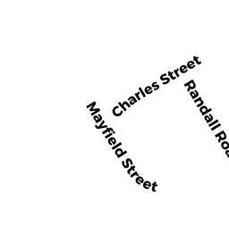
0 CHARLES ST
Owner Information
HOUCK DOROTHY A
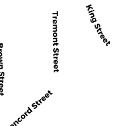
34 CONCORD ST
MAYNARD, MA 01754


Property Details
0 CHARLES ST is classified as a Undevelopable Residential Land.
0 CHARLES ST is valued at 19400. The land is valued at 19400 and the structures are valued at 0.
This property is in Zone R1. Confirm with local Zoning Board authorities to ensure there are no overlays or other easements on this property.
The most recent deed for 0 CHARLES ST is recorded at the local registrar in Book 13517, Page 405. 0 CHARLES ST was last sold on 1978-08-17 for 55000.
Assessment data from fiscal year 2022.
Flood Data
According to the FEMA National Flood Hazard Layer, this property does not appear to be in a flood zone. It may also be in an area not yet reviewed. Nonetheless, confirm this information prior to taking any action.
To view the flood hazards around this property, create a FEMA "Firmette" Map of the area around 0 CHARLES ST.
Broadband Internet Providers
| Provider | Type | Bandwidth (mbps) | |
|---|---|---|---|
| Verizon New England Inc. | DSL | 15 | 1 |
| Comcast | Cable | 1000 | 35 |
| T-Mobile | Fixed Wireless | 25 | 3 |
| GCI Communication Corp. | Satellite | 0 | 0 |
| HughesNet | Satellite | 25 | 3 |
| VSAT Systems, LLC. | Satellite | 2 | 1 |
| Viasat Inc | Satellite | 100 | 3 |
| Crown Castle Fiber | Fiber | 0 | 0 |
| Verizon New England Inc. | Fiber | 940 | 880 |
Broadband service provider data from December 2020.
Adjacent Properties
- 0 CHARLES ST EXT
(formerly Municipalities/Districts. Removed June 2009.) owned by TOWN OF MAYNARD - 74 ACTON ST
Electricity Regulating Substations owned by NSTAR ELECTRIC COMPANY - 40 CONCORD ST
Single Family Residential owned by DAWSON TR - 38 CONCORD ST
Two-Family Residential owned by MARKHAM RLTY TR - 0 CHARLES ST
Undevelopable Residential Land owned by HOUCK DOROTHY A - 68 - 70 ACTON ST
Two-Family Residential owned by HEATH, EILEEN M